Thursday, October 29, 2020

Foot Travel Only...the Paugussett Trail

"Foot Travel Only"

Foot Travel Only: By default, the 825-mile Connecticut Blue-Blazed Trail system maintained by CFPA is for foot traffic only, meaning no horses, bikes, or ATVs. The hiking trail system was created in the 1930's, and hikers want to preserve the natural character of the trail. Bikes and ATVs are much harder on the trail tread and can lead to unauthorized bypasses and severe erosion. Moreover, some of CFPA's system, including the Paugussett Trail, crosses private property with only an informal agreement from the property owner. Those property owners did not agree to allow bikes and ATVs on their properties and could react by shutting down the entire trail if a problem develops. Mostly this is a matter of etiquette, but where the trails cross state-owned properties like Indian Well State Park, it is also a violation of state law.  When in doubt, don't ride on a CT Blue-Blazed Trail

Note that not all trails in this system are actually blazed blue. For example the trails at Sleeping Giant are part of the system and are blazed all sorts of colors. But any trail blazed sky blue is almost definitely a major CT Blue-Blazed Trail. See  CFPA's map for the location of their trails. 

An exception: The rule is set aside where a trail crosses areas where bikes or ATVs are otherwise allowed by the landowner. This is the case for two miles of the Paugussett at Shelton Lakes. Bikes are allowed on the Paugussett at this time between Independence Drive south to the junction of the blue/white Nells Rock Connector. This is the heart of Shelton Lakes where there are eleven miles of trail popular with local mountain bikers. As it passes through this area, the Paugussett follows old roadbeds or is otherwise pretty gentle and not particularly vulnerable to erosion. It made sense to keep it open to bikes. 

Click map to enlarge

South of the junction with the blue/white Nells Rock Connector (0.75 mile from Buddington Road), the Paugussett leaves the old roadbeds and crosses terrain that is rockier via a narrow path. This section is closed to bikes. Blue-blaze hikers enjoy the more rugged character of the trail, and the trail tread should be left alone (it hasn't been). Signs indicate "foot traffic only" along this section. 

"Paugussett Trail 
Foot Traffic Only"

North of Independence Drive, the trail immediately becomes very wet and rocky, and the tread is far too sensitive for bikes or horses all the way to the end in Monroe.

What penalties are there for bike riders on the Blue Trails? For the most part nothing. This is about etiquette and respecting the trail and other trail users. CFPA began the official trail system in 1929, and volunteers have been working to maintain that system ever since. Bikes can seriously degrade the trails for hikers in only a few years. On state lands, riding on a blue-blazed trail is against the law, so riders could be given a ticket. At Shelton Lakes, no one is going to get a ticket. But if bike riders do not keep to the designated trails on which bikes are allowed, or continue to clear unauthorized trails or alter existing trails, then there is always the possibility of simply banning all bikes at Shelton Lakes. That is something that no one wants, so riders are asked to please respect the rules, respect the trails, respect the hikers and volunteers, and encourage other riders to do the same so that the trails remain open. Thanks for your support.

Wednesday, October 21, 2020

RecPath Topping at Lane St

Bill Dyer from the Trails Committee was out with Dan and Dave Landscaping today putting a fresh topping layer on the RecPath at Lane St and Wesley Drive.

That portion of the Shelton Lakes Recreation Path provided a temporary detour when the Lane Street Bridge was replaced.  When the temporary paving was removed earlier this year, the underlying crushed stone was firm, but too coarse for bicycle and other traffic.  Dan and Dave placed a 10 foot wide swath of crushed stone that is smaller than 3/8's of an inch in diameter to be a finer surface course for the RecPath.


This was about 450 linear feet of RecPath along the Lane St. Fire Access Drive.  The finished section ties back into the RecPath by the stone wall.


The fine surface layer is a little soft now, but a lot of people were still using it today.  The Shelton Highways and Bridges Department will come out and roll the fine stone with one of their rollers in the near future.  The resulting path will be smoother and easier for all users; including bikes, baby strollers and wheelchairs.  Wood chips may be placed along the sides.

It was a very pretty early Fall picture along that portion of the Recreation Path.

That portion of the RecPath also includes Shelton's Famous Chestnut Tree that you may have seen in the papers recently.

Thanks to the Shelton Conservation Commission for authorizing these improvements, Dan & Dave for doing a nice job, and Bill Dyer for organizing everything.


Monday, October 19, 2020

Trail Signs of 2020

People like trail signs and have been asking for more signage since the 1990s. 

It's one of those things that's great in principle, but  classic signs are time consuming and in the past have been prone to vandalism.  Over the last two years, we installed some routered signs at the Rec Path trail junctions and a few other places, and so far those signs have all survived. So it seemed safe to add a few more, and with the large number of Covid hikers this year, the signs were needed more than ever. There were a lot of new people on the trails not accustomed to dealing with trail blazes and maps. So over the hiking season, signs were added a few at a time. The 2020 signs tally now stands at:

 - 32 hand-routered signs 
 - 1 raised-relief header sign for the Birchbank kiosk
 - several turn arrows 
 - 16 hand-painted (not routered) signs at Indian Well

Birchbank's Chimney Junction

People still cannot rely on signs to tell them where to go. Trail users have an obligation to be prepared and bring a map (don't rely on cell phones when on an unfamiliar trail). But we've learned that many trail users either have no official map and no clear idea of the trail system (and are sometimes using apps like AllTrails, which is both confusing and inaccurate in Shelton), or they might be really familiar with one small part of a trail system (like the Rec Path) and have no idea what the trail junctions are or where the side trails lead. 

The blue/white Birchbank Connector is more inviting now

Also, most people don't know the names of the trails. When the Trails Committee members talk about the trails, they typically use the trail name, not the blaze color. We don't say "the red trail at Shelton Lakes." We say "Oak Valley Trail."  It's always a little sad when people walk on a trail several times a week for years and don't know the name of the trail. Then again, how would they know the name of the trail unless it's on a sign? The trail names are on the maps, but people tend not to look at the maps. Anyway, the trail signs let people know the names of the trails. 


Kiosk header sign - the hardest one of all

Mileage was added to some of the signs. We heard of some hikers on the Rec Path near Lane Street thinking they were near the Dog Park because the Rec Path goes past the Dog Park. It does, a few miles down the trail (the Rec Path is 4.2 miles long).  Mileage on a couple Paugussett Trail signs was also added for awareness of how long the blue trail is (13 miles) and how it connects major park areas. At the Birchbank's "Chimney Junction", for example, people walking on Birchbank Trail encounter a mileage sign for the Paugussett that shows they are half way between Indian Well and Webb Mountain. People like that sort of thing. And on the Rec Path near Silent Waters, a Paugussett turn sign lists the mileage to Indian Well. 


For people who think they are near the Dog Park

The Rec Path got several new signs at sharp turns

The signs are made from cedar, and routered by hand. Sure, there are CNC machines out there that can make perfect letters, but we strive for "tastefully rustic." Hand-routered lettering is classic for trail signs and has more character than machine lettering.

One of the trickiest parts of the process is transferring the lettering onto the boards. It sounds so simple and yet can be frustratingly difficult to pull off. A craft projector is used to beam an image of the lettering onto the boards, which is traced onto the wood with a pencil. The routering is loud and dusty, but goes pretty quickly once all the correct router bits have been figured out. It's the painting that takes the most time. 


Cedar boards and projector

Then it's time for installation. To discourage vandalism and give the weak cedar wood more strength, a backer board is used. Reclaimed trail bridge deck boards are used.  The back board is bolted to a tree or 4x4 post, and then the cedar sign screwed to the backer board with a variety of hardware. The signs most prone to vandalism may be installed very high on a tree, which requires carrying a ladder down the trail. 


This used to be a cedar tree.

What got signed? Trail junctions, for the most part. Confusing bends in the Rec Path. And there were some trail entrances as well. Boehm Pond Trails, Little Pond Trail, and the Senior Center entrance to the Rec Path were all signed. 

Voted the most confusing trail junction

Turkey Trot Trail along the powerlines was said to be the most confusing junction. As it happens, while heading out to install signs there, a hiker came up asking for directions. 


People didn't even know there was a trail here

Little Pond Trail was our least know trail. During installation of an entrance sign, neighbors walking past the trailhead stopped to ask if that was a trail. Yes, it is, and the sign proves it. 


Side trail off the Rec Path gets some advertisement

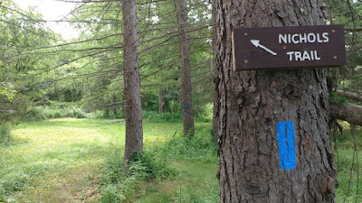
Nichols Trail at Nicholdale got a a few signs and a slew of arrows because that trail has some sharp turns in meadow areas that can be hard to spot amongst all the other mowed paths. 


Help for Nichols Trail


This spot used to be pretty confusing and easy to miss

The Pearmain Path at Nichols Trail junction got some clarity, as well as a sign cautioning people to wear bright colors during hunting season. 

The Pearmain Path at Nichols Trail

Early in the season, a bunch of arrow signs were hand-painted for Indian Well. These were not routered because the trail was deemed highly prone to vandalism. But the Covid crowds were wandering up and down the trails asking, "Where are the falls? Where are the falls?" Especially since the falls parking area was shut down during bridge reconstruction. These signs were a big help. 

Signs for Indian Well

Hopefully the new 2020 trail signs will last ten or twenty years. Signs are traditionally routered so they are still legible after the paint wears off. 

Saturday, October 10, 2020

Nells Rock Work Party

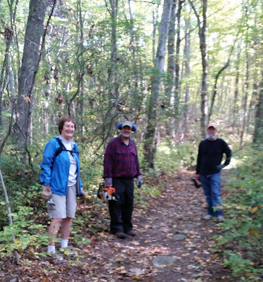
Saturday's work party was brush clearing along Nell's Rock Trail.  Seven volunteers met at the trailhead parking lot on Nells Rock Road across from Chordas Pond and L'Hermitage Condos.

All masked up and generally distanced for Covid safety guidelines when together.  We split up into teams to spread out around the trails.

The entry was pretty shaggy.  A lot of briars, and invasive species like Japanese knotweed were cut back hard near the entrance.  Controlling invasive species that crowd out native plants is usually toughest nead disturbed areas where there's a lot of sun and water.  The area near the parking lot used to be a municipal bulky waste dump.  It looks much nicer today as an open space park.

The parking lot fence and gate could use some work, and the trash barrel needs to be replaced. 


Various individuals and smaller groups tackled brush along the trails.  Further in the woods the trails were in pretty good shape.  A couple of step over blowdowns were left in place for now.

The trails were brushed out all the way from Nells Rock Road to the powerlines, RecPath, and Basil Brook Bypass.  They are in good shape for some good Fall hiking weather.  Thanks to Ellen, Mark, Ted, Bob, Mike, Bill & Terry for coming out.


Friday, October 2, 2020

Full House for the Full Moon Hike

We scheduled most of our guided hikes earlier in the year prior to Covid.  We had to cancel some due to the pandemic but thought we could have the Fall Full Moon Hike at the Land Trust's Nicholdale Preserve on Rt. 110.  The traditional campfire and marshmallow roast was omitted to space people out.  It was assumed that most people probably wouldn't come out for that.

Boy, were we wrong and how. 

The main parking lot at Nicholdale was filled a half hour before the 7:00 start.  It was a good thing that we cleaned out all the storm damaged trees a couple of weeks earlier, otherwise there wouldn't have been any room to park.

The overflow lot overflowed onto Rt. 110.  People were parking up and down the road and on side streets.

This was probably the most well attended hike that we've ever hosted.  There were lots of families with kids and dogs.  We got everybody off the road and hiked around the Nichols Trail in the dark.  There were stops along the way to see the stars from the Land Trust meadows, but the full moon hadn't risen yet.  

It was a warm night so we enjoyed that stars and dark with the accompanying music from Fairview Farms haunted trails in the background.  It was good that people were able to spread out and wear their masks during the hike. 

Everybody made it back, we think, in the dark to the parking lot to finally see the Full Moon rise.  We counted 157 people and 7 dogs.  We also had to turn away people.  It was insane.

It took a while to get everybody out of the parking lots, but everyone made it ok thanks to Bob's traffic directions with a flashlight on Rt. 110.  Next year we'll bring more lights.  Everyone seemed to have a fine time even without the marshmallows.   Thanks to Val, Bob, Bill, Mike, and Luis for publicity, guiding and traffic control.  Thanks to everybody who came and thanks to the Shelton Land Trust for letting us use their property.