PARKING: There is a big dirt parking lot on Nells Rock Road, 0.6 miles south of the junction with Shelton Ave, across the street from Chordas Pond and L'Hermitage condominiums. This is sometimes called the "Abby Wright" parking area after the former owner of the property. Approximate address is #160 Nells Rock Road. See on Google Maps. You will know you are at the correct parking area if you see a sign kiosk on the opposite side of a split rail fence.
BLAZE COLOR: White rectangles are painted on the trees. When there are two offset blazes on the same tree, the higher blaze indicates the direction of a turn you may miss. If you suddenly realize you aren't seeing white blazes, turn around and go back the way you came until you see them again to pick up the trail.
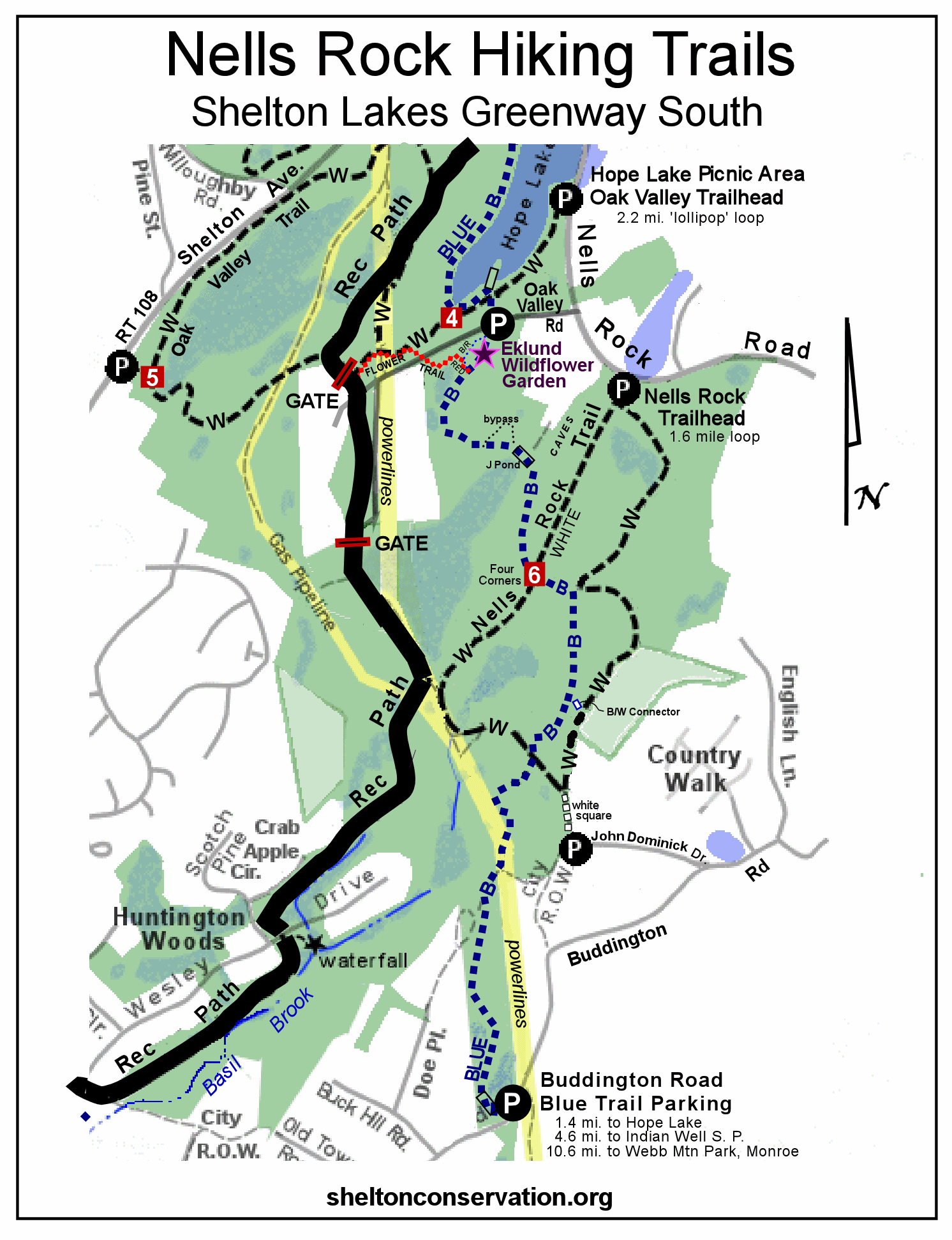
TRAIL MAP: To print out a full trail map for this area, click HERE. The hike for this challenge is highlighted in orange below.

HIKE DESCRIPTION: We will be doing the loop counterclockwise because there are two rocky spots that are easier to go up than to go down. From the parking lot, head straight down the trail, following an old woods road all the way past the junction we call "Four Corners," and continue on to the powerlines. Be sure to follow the white blazes carefully for this entire walk.
Just before the powerlines, the old road climbs up some ledge. We call this "Gator Glide" because the Trails Committee chairmen Bill Dyer once misjudged his speed on the Gator while going down this rock and became airborne. Also, on rare occasion after heavy rains, water has been known to cascade or glide down this rock face.
The trail crosses under powerlines that were rebuilt by Eversource in 2023. The major construction project disrupted the trail system, but everything should start growing back in 2024. Go directly across the newly graded powerline corridor to find the former utility road, blazed white. The trail will curve to the left and follow the powerline corridor. Basil Brook Bypass will come in from the right and the two trails share the same tread.
Just before the next set of towers, the two trails split, with Nells Rock Trail going left up some steep rock steps built by Eversource, recrossing the powerlines, and head back into the woods to follow an old woods road.
Continue along the white-blazed old road, crossing the blue-blazed Paugussett Trail, and then come to a junction with another old road. Follow the white rectangle blazes to turn sharply left (the right-turn option is an access trail to John Dominick Drive, marked with white squares).
Keep right at the next junction with the blue/white trail. The trail gradually bends to the left and will turn sharply right just before Four Corners (if you arrive at the Four Corners sign and blue trail, you missed the turn - go back a short ways to find it). Continue following the white blazes, crossing a small bridge, and arrive back at the parking lot.


No comments:
Post a Comment