Thursday, December 28, 2023

Birchbank Drainage Wars: Episode #179 - "The Culvert"

The Cascades at Birchbank

Challenge question: Where does Upper White Hills Brook flow to? That's the scenic brook at Birchbank with the cascades, two bridges, and a random chimney in the forest. 

Sorry, that was a trick question. It doesn't flow to anywhere, but disappears into the sands of Birchbank. Once the brook hits the big flat area at the bottom of the hill, it braids out into various ever-changing channels across the sandy floodplain.  During a typical dry summer, the water will disappear into the ground.  If it's the wet season, the channels will come back together when they hit the railroad embankment, which acts like a dam to keep the brook from reaching the Housatonic River. 

LIDAR image showing brooks, recharge ponds, and RR tracks
(click to enlarge)

(As an aside, people often assume there must also be a matching "Lower White Hills Brook." There is not. This is a brook that flows through an old Huntington district called "Upper White Hills." So the word 'upper' describes the district, not the brook.) 

One of the smaller recharge ponds. 
The water level dropped after ice formed.

Water in the man-made channel along the railroad tracks will make it's way to the first of several man-made groundwater recharge ponds that feed a wellfield operated by the Aquarion Water Company. The wellfield is only used in times of drought, since it's expensive to pump the water out of the ground and up the hill and yonder to Means Brook Reservoir.  The recharge ponds were originally designed for Housatonic River water to be pumped in, but are now filled exclusively with Birchbank runoff.  Aquarion's pipeline goes straight up the precipitous hill at the trailhead parking lot. Pro tip: Don't try to walk up the pipeline, it's steeper than it looks.

That's how the drainage normally works at Birchbank. There are some smaller intermittent waterways that spill down the hillside to feed the recharge ponds, like the little brook near the bench. But every so often, maybe once or a few times a year during the rainy season, we'll have a lot of rain when the recharge ponds are already full and can't take any more water. At that point, the excess water runs south down a man-made channel at the base of the railroad tracks to an old culvert that crosses Indian Well Road and the tracks near the trailhead. It's right where the road crosses the tracks. 

This old culvert channels floodwaters across
Indian Well Road and the tracks

Did the brook always disappear into the sands or was it diverted and captured?  LIDAR images seems to show an old channel going straight to the Housatonic, although it most of the water probably always sunk into the sands because the railroad track were built right across the channel with no bridge or culvert.  The recharge ponds were not built until the 1970s. 

At any rate, that all seemed to be working pretty well. Occasionally the emergency overflow channel would get clogged up with fallen trees at the south end, and then the floodwaters would jump the channel and flow across the Plant Management Area, spreading invasive seeds. A volunteer trails crew recently cut up some of the logs that were blocking the channel. 

And then, during an exceptionally rainy day last week (maybe 4" on top of saturated ground), we were sent the picture below: 
Birchbank Trail. That's not good.
(Photo from Ted)

We had never seen the water that high. In the past, it never even got up to the trail, and now it was a foot or two deep on the trail. A few hours later, the water had receded by about a foot, but was still up to the top of the old stone culvert and swirling into it with great force and (photo below). 

Flood waters going into the culvert

As we suspected, when the flood waters dropped, there were some logs, branches, and leaves clogging up part of the culvert. Once the water level receded to a safe level, the clog was ripped apart, and backed-up water really gushed into the culvert. 

Yup. The culvert is clogged. 
(Photo about 1 week after the flood)

The biggest log was too heavy to drag away. After about ten days, the channel was completely dry and the log could be safely cut up and removed. The surrounding thorny brush was also cut back. It had been catching leaves and sticks and made access to the culvert difficult. Once the work was done, the old stone culvert was revealed. It may date back to the 1800s and is pretty big inside (maybe 5 feet tall?). Take a look. 

All cleared!

This is the same view point as the previous flood photo 

The culvert was cleaned out just in time as it turned out, because heavy rain was forecast for that night. The channel was also cleaned out where flood waters had created dams. The next morning, water was everywhere and once again flooding Indian Well Road at the state park. What would Birchbank look like? 

The culvert. Wow. 

But the trail isn't flooded. It's a normal flood.

It was surprising how much water was flowing through the culvert considering the channel was bone dry the day before. Good thing the log had been cut up and carted away the day before, or it would have been blocking the culvert again. At any rate, we're now aware that we should be checking that culvert routinely or the trail can get flooded. 


Saturday, December 9, 2023

Rigging Up These Lights

Bill Dyer had a bright idea to put holiday lights on the Trails Barn, so Saturday we did.   We added lights on the Old Barn too.

Bill, Mark, Ellen, Val, Luis, Mike, Mark & Terry fiddled around with lights, unrolled extension cords, plugged in plugs, set time on timers, didn't fall off ladders, hammered nails without hitting thumbs, ate some doughnuts, and did whatnot to put lights on the 2 barns and the trees this morning.

The New Barn and the winterberry bush were very festive looking.

Hank the Hiker was spinning on the cupola this morning.  The wind was unsettled with the storm coming up from the south.

Mark was tacking in some nails for lights, and Mike was steadying the ladder so it didn't tip over.

Luis, Bill, Ellen and Val were also stringing some lights on the Old Trails Barn.

It was a busy morning around the barns; a lot of folks were using the dog park, and Allison, Paul and other volunteers were working to put the flower gardens to bed for the season.

Came back at dusk and the timer was working.  The Parks & Rec folks are going to hang some additional lights along the Barn fascia next week, and some wreaths should be going up too.  It should look nice for the holidays.

Sunday, December 3, 2023

2 Cycle Gas Preparation

We use a variety of power and hand tools.  The power tools really help with maintaining all of Shelton's 31 miles of trails; particularly given the limited number of core volunteers. 

When we were first starting out we had a variety of tools that used different mixtures: 50:1, 40:1, 32:1 and it was hard to keep things straight.  We standardized on using a 50:1 gasoline: 2 cycle oil mixture for all the tools to make our tasks simplier and avoid confusion.    Keeping the fresh, proper 2-cycle fuel mixture is the first step in starting and using our trail tools.  The typical 50:1 mix we use is:

  • 1 gallon 89 Octane Gasoline (high test, but not super hi-test)
  • 1 small container of 2 Cycle Oil (pre-mixed for 1 gallon of gas)
  • 1 oz. of SeaFoam stabilizer

The 2 cycle oil is generally dumped into the empty gas can before adding the gasoline to help with mixing.  The 89 Octane was suggested by Bill Girard; CFPA's chainsaw instructor, and it seems to work well for us.  The stabilizer helps keep the gas fresh for a few months.  We generally have two to three 1 gallon cans that we rotate to use up the older gas first.

Note of Caution:  Most of the little 2 cycle oil containers are pre-mixed for 1 gallon of gas, but check the label.  We have a few containers that are pre-mixed for 2 gallons of gas.  Don't put two much oil in or the tools will sputter.  And don't put the 2-Cycle oil in the Gator or DR Mower - those take the regular gas in the larger gas containers.

Use the little mixing shot glass to pour out the SeaFoam stabilizer and add it to the gas can.  Make a note on the label of the date it was mixed up, so we can use up the older gas first.

Trail Safety Tip:  Don't use that shot glass for drinking.  SeaFoam may be good for engine innards, but not so sure about your innards.  And that goes for any of the other measuring containers on the fuel/chemical area of the Barn.

There you have it; another valuable trail maintenance guide from your friendly neighborhood Shelton Trails Committee.

Sunday, November 26, 2023

Turkey Trot Hike

The 2023 Turkey Trot Hike went off without a hitch.  A dedicated group left from Shelton Intermediate School to work off some of that holiday stuffing and gravy.

It was a brisk start, but we warmed up quickly.  We were able to do the outer loop on the Turkey Trot Trail now that Eversource was done with construction along the powerlines.

The oak leaves were a little slippery on some of the slopes, but it was a fine hike.  Wish I'd taken a few more pictures.  The route crossed the powerlines, out to Willoughby Road, and back over to Silent Waters and the school.  There were a lot of fellow walkers, hikers, and families out enjoying their post Thanksgiving outing.

Saturday, November 18, 2023

Stockmal Bridge Successfully Replaced

The bridge over the stream on the Stockmal Trail was falling apart - literally falling apart.  Despite recent emergency patch repairs by Teresa Gallagher, this bridge was one fat butterfly landing on it while someone was walking their dog across it from collapsing into the brook.  It was in sad shape and needed to be replaced.

And today it was.  The rain forecast from yesterday looked like it was going to hold off, and it did, until we got about as far out in the woods as we could, and THEN it rained.  But we had our raincoats and muddled on.  We dropped off lumber and materials and wheeled or carried them in with a great group of volunteers and high school students (2 students - thanks Jason and Jevu) who hauled in the lumber along with Luis, Val, and Ellen.  


Here's the Trails Committee Proof-Loading the new bridge after construction.   Not only do we stand behind our work we also stand on top of it.  If it's safe enough for us it should be safe enough for the public.

Here we are setting up to remove the old bridge.  Note the recent patch boards in the far end.

The causeway had been extended by Teresa earlier in the week.  This was the approach across the floodplain to the bridge.

The old bridge was used as a bed to construct the new bridge.  Here is Mark working on the new stingers.

So, we glued, screwed, and bolted the 16 foot long beams together.  Mark is applying the construction adhesive.

Mike and Bill cut the spacing blocks for the bridge undercarriage.

The new bridge frame was assembled, and then shifted off to the side so we could move the existing bridge out of the way.  It was heavy so we tried to lighten the weight of the existing bridge by taking off some of the lumber.  Mike removed some deck boards from the existing bridge to lessen the weight when we moved it.  The bridge was pretty heavy due to the soggy boards.  Luckily, the existing bridge did no collapse into the stream when Mike removed the rotten deck boards, but Mike really tried.  Note that Val was standing close to one of the abutments, just in case everything went south in a hurry.

We got the old bridge dragged out of the way, put the new bridge back into place and started screwing 2x6 decking boards back into place.  Jevu and Jason helped Mike and Terry screw them in, along with Bill and Mark.  Everyone got a turn.  We had a great time lining up the boards, stripping driver bits, dropping things into the stream; in short, a real trail work party.  But we got it done.  And lowe and behold, the new bridge is much sturdier than the old bridge.

Mike and Luis reattached some boards to the old bridge section so it was safer to walk on.  There are a lot sticks and mud scattered in the muck.   We left the old bridge in the swamp temporarily for elevated footing during flooding.  We plan to replace it with a proper section on bog bridge in 2024, but this should hold for now. 

It was a good, if wet, work party.  Thanks to Jason, Jevu, Luis, Mark, Annie, Val, Ellen, Bill, Mike and  Terry. And Thank You to the Bennett and Stockmal families for hosting the trail on their property.

There was a lot of pre-planning and materials assembly by Mark, Ray, Ellen & Bill, but it all made things go smoother in the swamp on Saturday.  The sun came out and it wound up finishing as a nice Saturday Afternoon.  The Stockmal Bridge is replaced and we can check this one off the To Do List.

Tuesday, October 31, 2023

Stablizing the Old Barn

Bill Dyer and Mark Vollaro met Dan & Dave Construction at the Old Trails Barn to see if something could be done to stabilize it before it falls down.  The Barn dates back to the 1800's, and time and the elements have taken their toll.

Dan & Dave checked the barn and the timber foundation was pretty shot.  They tried to tie straps around the Barn and pull it back to vertical, while jacking up the foundation.  The Barn started to shift a bit, so they did some quick work.

They were able to shore up the northeast corner of the Barn and add some rocks under the sill to give it some more support.  They also added some interior bracing to the post and beam timber frame inside the Barn.

When the Barn shifted Dan & Dave had to make a few minor adjustments to the door frame in order to close them again.

The Old Barn looks better.  Now we'll be able to store our supplies and lumber out of the weather.

The Barn still has a littttle curvature to it, but the doors open and close.  Maybe we can get another 100 years of it. 


Saturday, October 28, 2023

Fall Full Moon Hike

We were blessed with some uncommonly warm and dry weather for our Full Moon Hike.   The hike started on the RecPath at Lane St and proceeded along the RecPath to Great Ledge.  It was about 1.5 miles each way, total 3.0 miles.


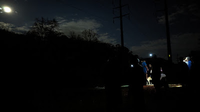
There were a lot of flashlights and headlamps, which made it look a little like the movie Close Encounters of a Third Kind at the beginning.  We think that we started with about 22 people.

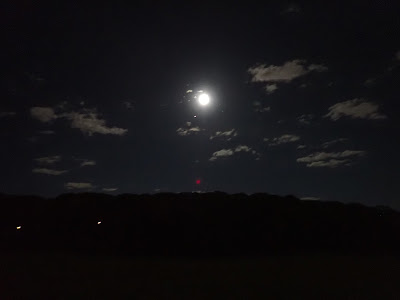
It was a beautiful night out.  The moon was clearly visible throughout the hike - this photo was taken at the Land Trust Meadow on the Hawley Preserve.

The views of the moon were really good when we came out to the powerlines by Great Ledge.  Everyone took in the night sky.  I think it was Saturn that was just below the moon.

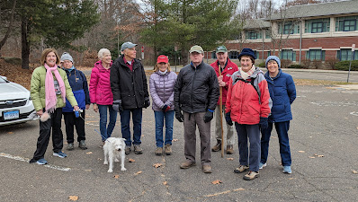
And we had a pleasant walk back.  We think we finished with about 12 people.  Some turned back earlier near Huntington Woods.  So we were batting .500, which was good.  We had wanted to have another night hike for a while, and this one turned out really well.  Thanks to everyone who came out.

Hey It's Not Raining Today; Clearing Brush on the RecPath Oak Valley Rd to Great Ledge


We had a great turnout of volunteers at Oak Valley Road this morning.  We had been rained out a lot of Saturdays this fall, but not today.  

On group when N. along the RecPath, and the rest went S.  We were cutting back brush along the side of the RecPath some of these areas were closed during the Eversource powerline construction.

There were also mundane tasks, such as finding, and clearing, drainage pipes under the RecPath and channels on on either side of the Path.

We cut back a 2' wide shoulder on each side of the 8' wide RecPath.  Some native shrubs such as these Winterberries were preserved.  Winterberry provide food for birds in late fall and early winter.


Cutting out around the corners too, for better sightlines.

Eversource had restored the portions of the RecPath that had been damaged.  They mulched the crushed stone RecPath for some reason.

The stones along the edge with Spooner Swamp were a nice touch.  The top course of stone needs to be checked.  It looks like Eversource used coarser stone than we specified - something to be discussed for the final punch list with Eversource.

Saturday, October 14, 2023

RecPath Work Party at Lane St

 We managed to squeeze in a work party at Lane St. before the rain hit.  The meadow had grown in so much that our 8' wide RecPath was down to 2' in some places.

Mark had the crew clear out the briars and stubs around the Sycamore Tree.

Val and Annie cutting brush and raking along both sides of the trail.

Dora & Jason cutting brush.

The crew clearing out debris.

After:  the RecPath edges still need work, but they are a lot better than they were.  Thanks to everyone who came to help out.